|
|
DEGRADATION AND CONTROL PROCESSES |
|
Degradation process:
|
Rill erosion. Water erosion by concentrated surface runoff.
|
Description:
|
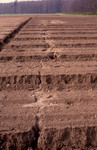
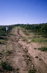
A short distance downstream, the roughness of the terrain and increased flow mean that sheet runoff is concentrated into channels, called rills, in which the velocity of the water increases, detaching soil particles from the bottom and sides of the channel. The flow increases down the slope, with the channels deepening and becoming gullies. Rill runoff causes the loss of mineral particles, organic matter and nutrients.
Importance: great in arid and semi-arid regions.
|
Click on the image
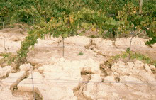
Concentrated runoff erosion: rills in a
vineyard. Anoia (J. Porta)
|
Soil functions affected:
|
Biomass production (reduction of crop yields and the need for greater inputs), environmental functions (filtration), hydrological function, reduction of carbon sequestration, functions for preventing offsite effects (sediment supply during floods, the silting up of dams).
|
Diagnostic criteria:
|
Clearly visible incisions that are less than 30 cm deep. Channels less than 30cm deep. The problem is hidden by ploughing but is not solved unless action is taken to deal with the original cause.
|
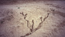
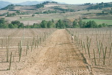
Click on the image
Rill erosion caused by
excessively intense
erosion (J. Porta)
|
Click on the image
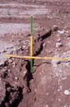
Concentrated runoff erosion:
measurement of a rill incision
(J. Porta)
|
|
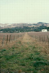
Click on the image
Concentrated runoff erosion: a rill in a field of bare soil. Les Garrigues
(J. Porta)
Click on the image
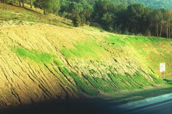
Concentrated runoff
erosion: rills on
a non-revegetated
motorway embankment.
Anoia (R. M. Poch)
|
Prevention and control:
|
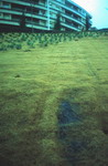
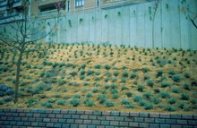
Reduce the volume of surface runoff. This can be done by employing cultivation techniques which increase soil surface roughness or by eliminating excessively long slopes. Implementation of construction-related conservation measures to reduce slope length and promote non-erosive drainage of excess rain water. Terracing and channel design should be calculated and projected according to local rainfall characteristics and the terrain morphology, so that runoff is not erosive. In cases in which this is not possible, runoff channels should be protected with vegetation or hard revetments, as in public works and landscaped gardens.
|
Click on the image
CDrainage channel
and rill .
Anoia (J. Porta)
|
Click on the image
Drainage channel prepared for sowing.
Anoia (J. Porta)
|
|
Click on the image
Drainage channel protected from
erosion by vegetation. Anoia (J. Porta)
|
Click on the image
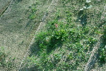
Use of geotextiles to protect a road embankment from
erosion and facilitate revegetation
(R. M. Poch).
|
Click on the image
Plantation of
ornamental plants using
geotextiles and localised
irrigation in a garden
located on a slope
Lleida (J. Porta)
|
Click on the image
Use of geotextiles and localised irrigation in gardens
on slopes to prevent erosion and encourage the
establishment of vegetation. Lleida (J. Porta)
|
|
|

;)
;)
;)
;)
;)
;)
;)
;)
;)
;)
;)