|
|
WHAT CAN SOIL INFORMATION BE USED FOR? |
|
The information obtained from the measurement of soil properties constitutes a key and long lasting element on which to base decisions relating to the most appropriate uses and management of soils, environmental protection and land planning. Synthesising the information reflected on a map and/or stored in an information system evidently implies a need for field work, laboratory work and office research.
The practical uses to which systematic descriptions, classification and, if appropriate, soil mapping can be put, relate to soil evaluation process. In this final phase of the procedure, quantitative and cartographic information is interpreted according to certain pre-established evaluation criteria.
|
 |
The utility of soil data lies in the fact that it enables land planning based on better quality soil protection criteria. It therefore has the following uses.
– to undertake work on the land itself:
– to help apply the legislation contained in the Pla territorial general de Catalunya,
– to promote sustainable urban development, as foreseen by the law of urbanism
– to contribute to the inventory of landscapes of Catalonia, in accordance with
legislation relating to the Protecció, gestió i ordenació del paisatge
– to assign land uses,
– to help promote landscape architecture based on a knowledge of soils
– to help develop indicators for sustainable development,
– to delimit coastal wetlands,
– to study the archaeological remains of settlements.
|
|
|
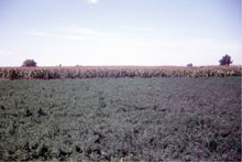
– actions related to with the agricultural sector
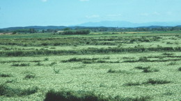
– the use of agricultural land to prevent soil degradation and undesired
environmental impacts
– providing assessment in order to determine the suitability of soils for intensive
uses, such as irrigation, horticulture or fruit-growing and/or for uses
associated with precision agriculture,
– assessing water retention capacity and the available of water to plants,
– assessing the modernization of traditional irrigation systems and their conversion
to automatic systems,
– identifying and studying areas at risk from erosion and monitoring areas already
subject to active erosive processes.
– actions related to water
– identifying the drainage conditions of soils and shallow water tables
– evaluating the vulnerability of shallow water tables,
– establishing areas of protection for water catchment.
|
|
|
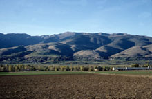
– actions related to public works
– identifying areas with potential problems (drainage, erosion, swelling clays,
gypsum, salinity, etc.) so that these can be taken into account when
planning new infrastructure ,
– evaluating the suitability of new items of infrastructure: roads,
septic tank filter fields, buildings, leisure facilities, etc.,
in order to reduce their cost and increase their safety,
– protecting natural resources (water, air, landscape, soil).
– actions related to environmental quality
– preventing the loss of soil biodiversity,
– using soil information to protect biodiversity,
– implementing hydrological-forestry conservation plans,
– combating desertification,
– determining geochemical backgrounds and identifying heavy metals,
– monitoring the storage of carbon in the soil in relation to the
effects of global climate change,
– using soil information in environmental modelling,
– monitoring changes to soils: over years, decades or even centuries
|
|
|