|
|
CHARACTERISTICS OF A MAP |
|
MAP UNIT
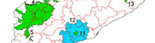
A soil map shows the distribution of different kinds of soils and miscellaneous areas in the landscape using soil map units.
Each map unit is represented on a map by a collection of delineations which have the same semantic content (the same definition and the same attributes, which vary within a given interval) and a similar meaning.
On the map legend, the map unit explains how the limits between polygons have been delineated. The delineations or polygons of a given map unit are identified with the same colour, number, letter or letters, or labelled with an alphanumeric symbol that facilitates identification.
|
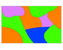 |
At a specific scale:
4 map units,
9 delineations or polygons
|
It is possible to employ different criteria to establish a map unit, but the style chosen must always be compatible with the objective and scale of the map in question. The quality of the information provided by the map units increases with: the density of the observations, the scale of the map, and the complexity of the mapped area.
On detailed maps, some map units represent areas dominated by a single soil series. In such cases, the map unit corresponds to a single classification unit. This only occurs with detailed soil maps and with the distribution models of simple soils; it does not occur in other cases, where the map unit represents areas dominated by two or more soil series (more than one classification unit). This is always the case on small-scale soil maps.
Soil map units are labelled according to the individual or different soil series that predominate within the unit in question. A smaller percentage of each map unit corresponds to other soil series (impurities or inclusions) whose names are not included in the map unit, buy whose presence is indicated.
|
|
<< back |
|
|
|