links of interest
information of interest
documents of interest
start
sitemap
SOIL PROTECTION Catalunya - the Balearic Islands / Principality of Andorra
soil protection (general information)
Vienna Soil Declaration
soil functions
sustainability criteria
degradation and control processes
soil protection criteria
soil quality indicators
soil maps
what is soil information used fort?
the purpose of soil maps
soil series and correlation
characteristics of a soils map
management and interpretation of soil information on a digital interface
Soil Series and Soil Types catalogue of Catalonia
presentation
criteria
soil Types (> 2010)
soil Series (1993 - 2009)
CHARACTERISTICS OF A MAP
Soil mapping includes the research necessary to: – determine the most important characteristics of the soils (pedon description) pediones). – classify the soils into defined classes and other taxonomical units – establish and delineate on maps the borders between different soil types based on soil formation factors. – condition and predict the adaptability of soils for different uses (interpretation and evaluation). INDEX – MAP SCALE – ZOOM EFFECT – SOIL MAP LEGEND – MAP UNIT – IMPURITIES OR INCLUSIONS – TYPES OF MAP UNIT • SOIL CONSOCIATIONS • SOIL COMPLEXES • SOIL ASSOCIATIONS • UNDIFFERENTIATED SOIL GROUPS • TAXADJUNCTS • MISCELLANEOUS AREAS – SOIL PHASES – QUALITY OF SOIL MAPS – QUALITY CRITERIA FOR MAPS
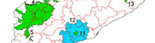
map of mapped areas
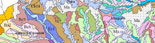
maps of existing soil
search by municipality / parishes
search by quadrate
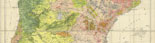
small scale maps and maps of historical interest
bibliographical references
soils in images